
CONCEPT DEVELOPMENT
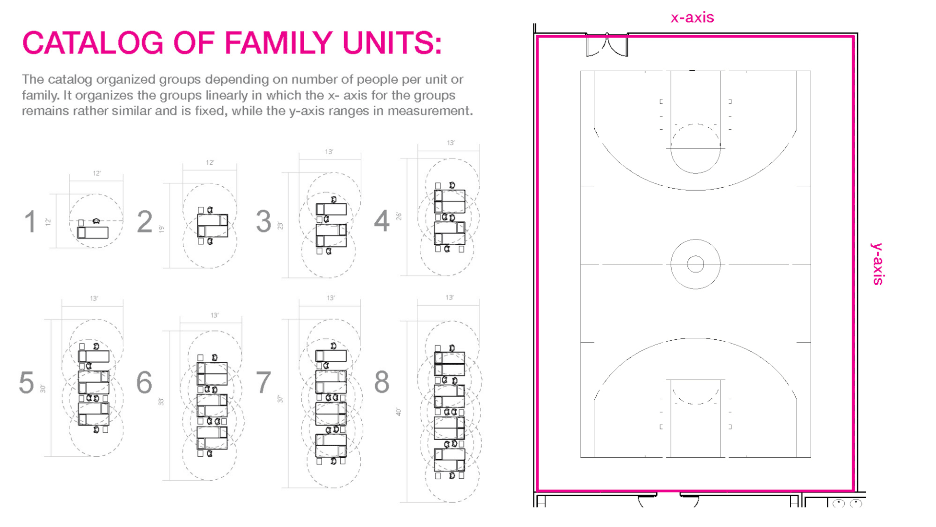
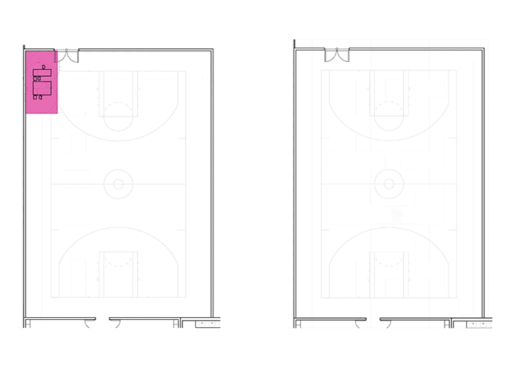
The spatial logic organizes the area through striations that divide the space by the fixed length on the x- axis given from the catalog.
4’ of space is given to those lines of division so that they operate as circulation, while the remaining space is given to occupiable area where people can linearly organize themselves as so within their time of arrival.
Collective Grouping vs. Individual Organization
Given the comparison between strategies, collective grouping increases the given occupancy by approximately 17 people compared to that suited to individualized organization while remaining safe under COVID-19 protocols.
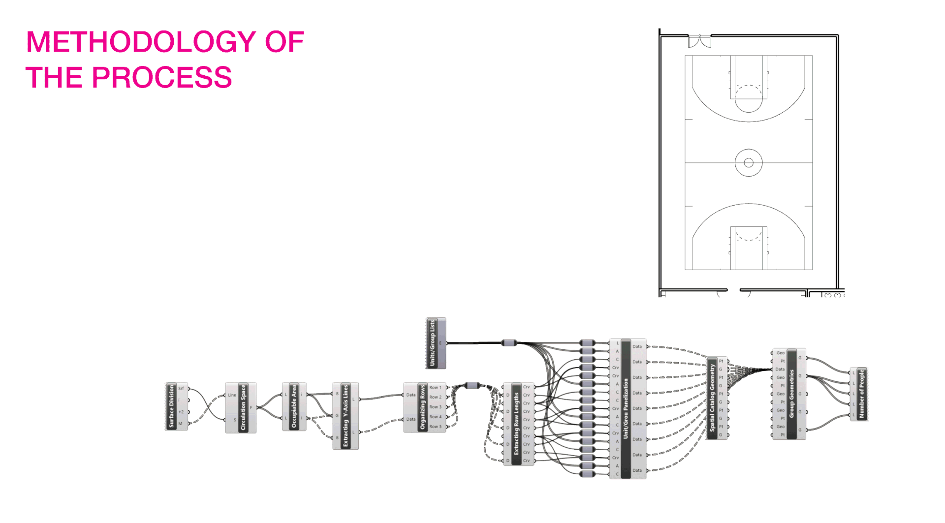
The methodology of the script used to visualize these plans is more valuable than just the one comparative scenario. It operates flexibly to where you can based it off of any surface area, to where the radii and widths per person given are adjustable to whether it’s for long term or short term sheltering, with this case using long term. As mentioned before, it accommodates circulation, occupancy area, then uses the lengths of the rows to determine which units fit given from the list (which varies in each instance). Using the catalog drawn previously, it allocates the geometry as such and calculates the amount of people in a configuration.
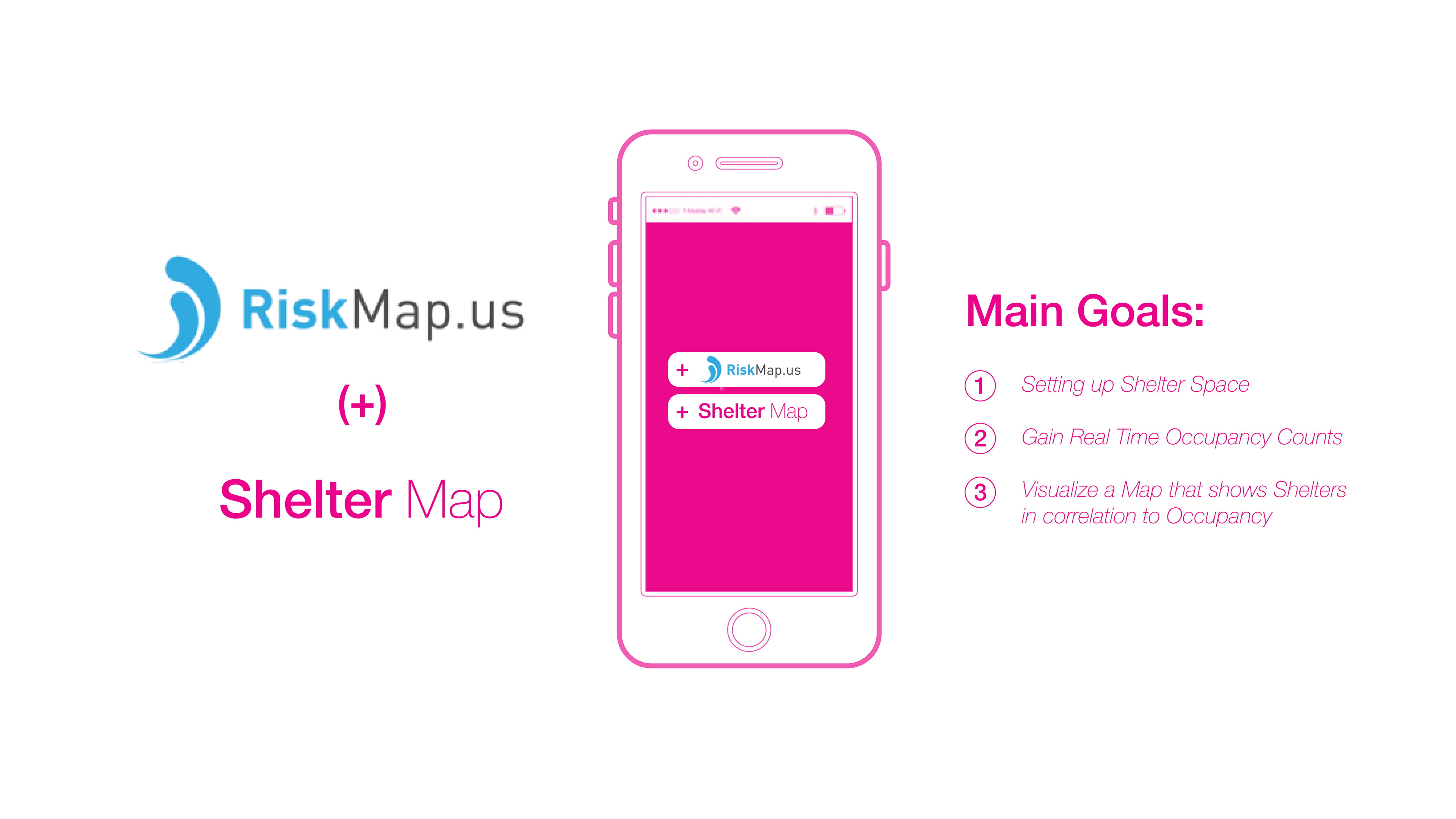
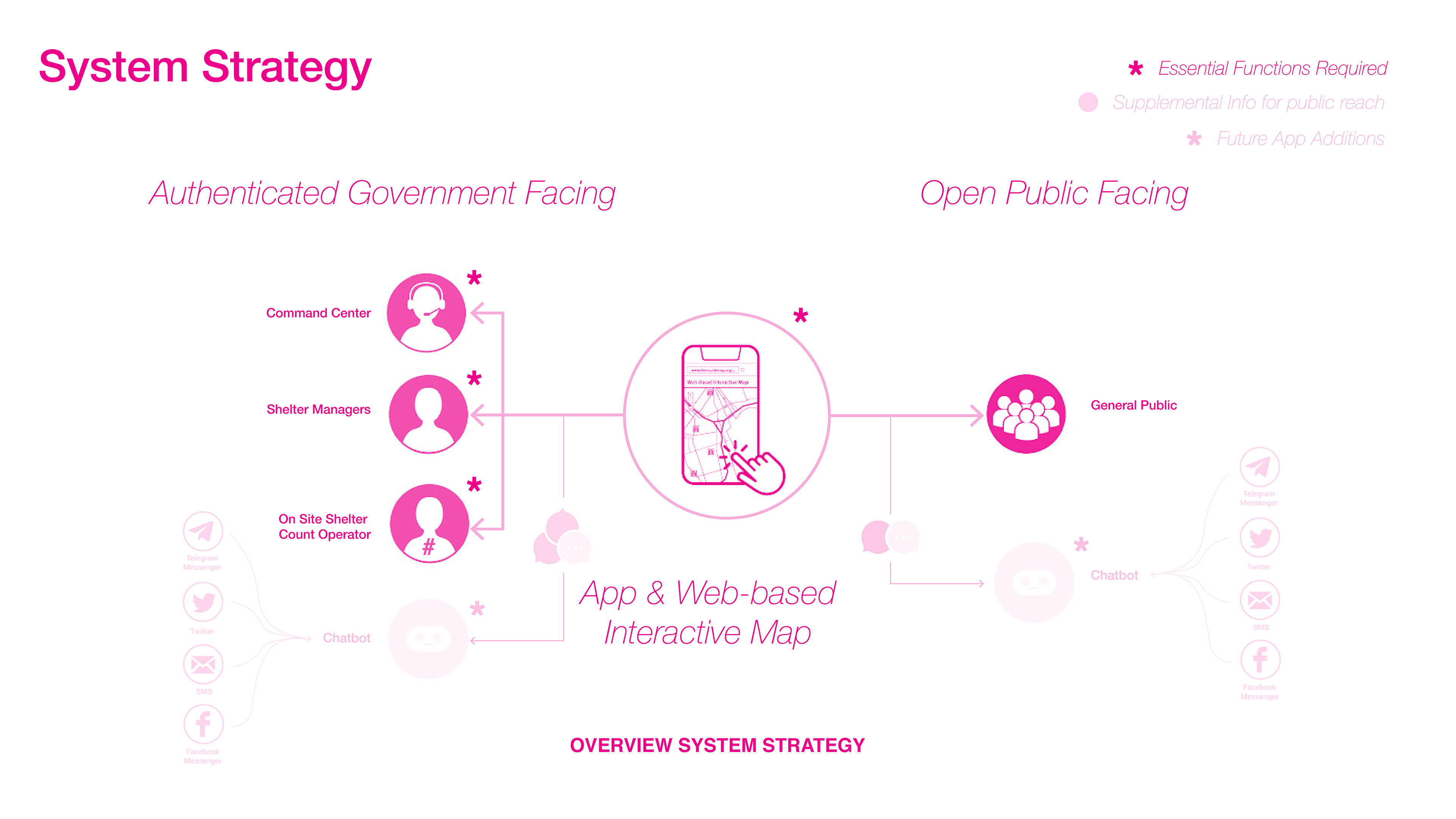
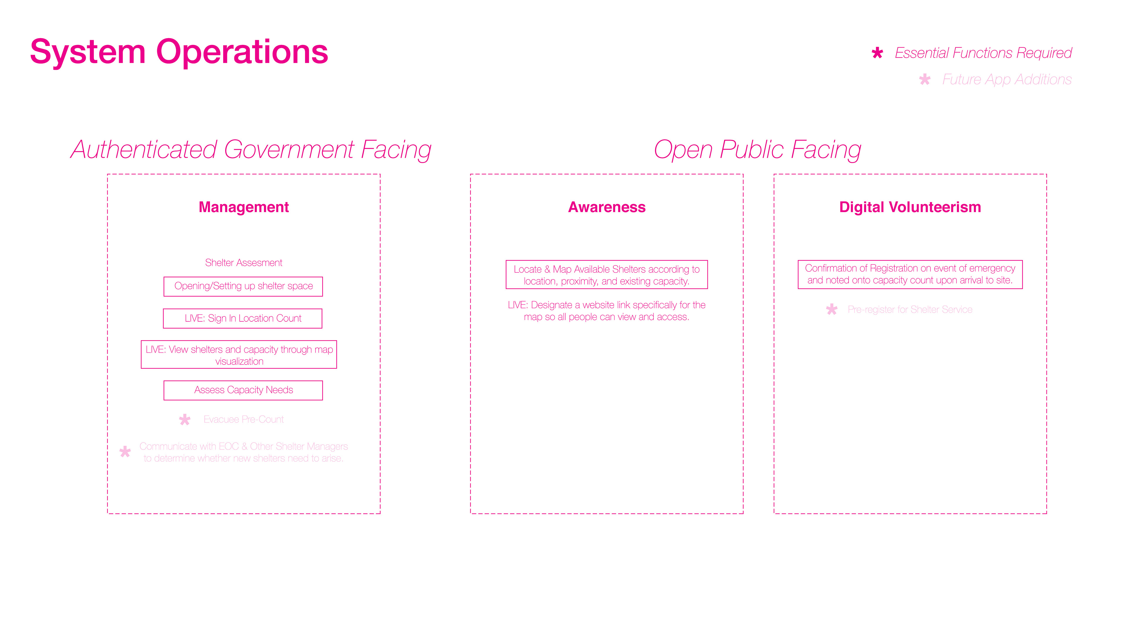
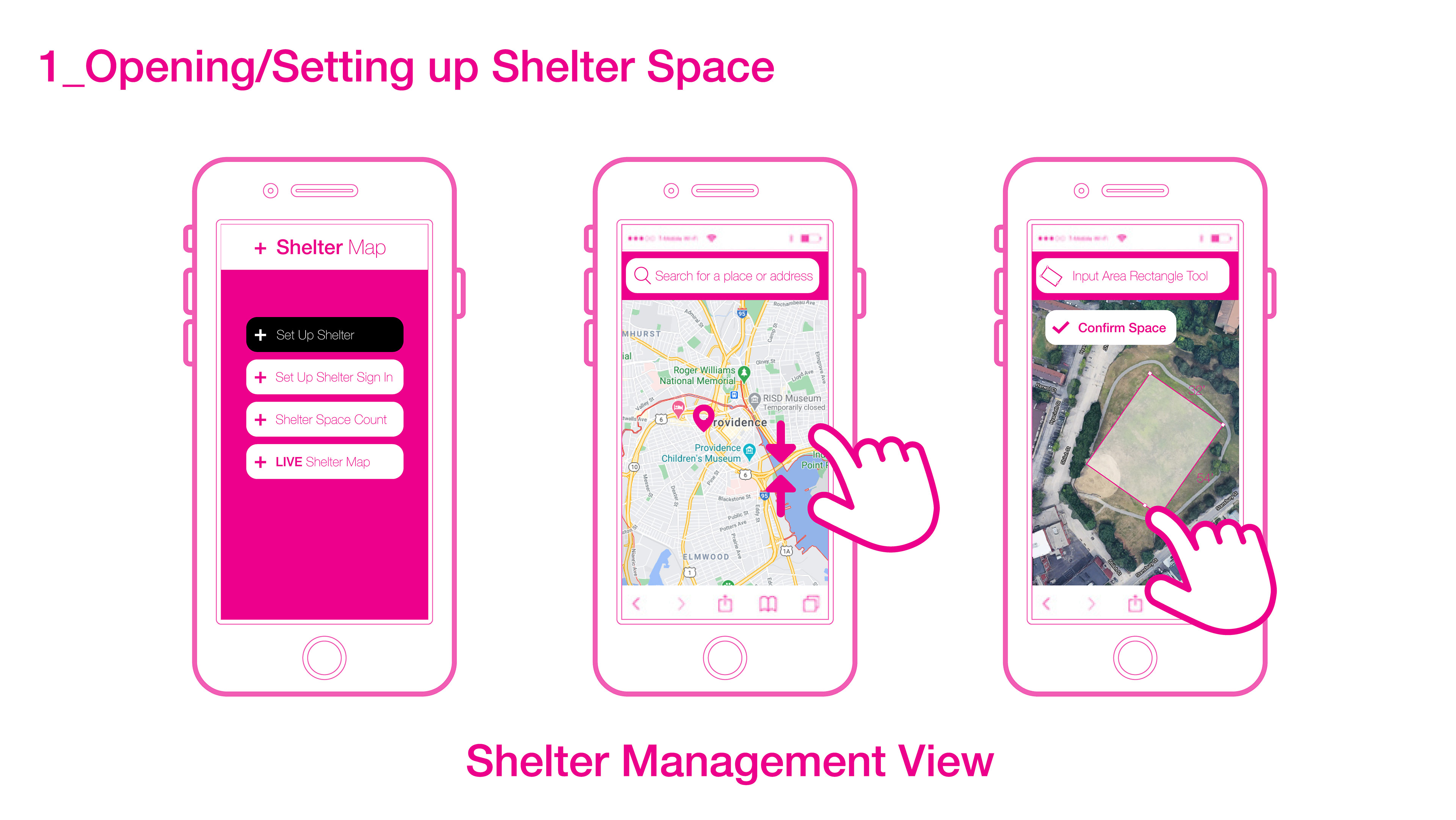
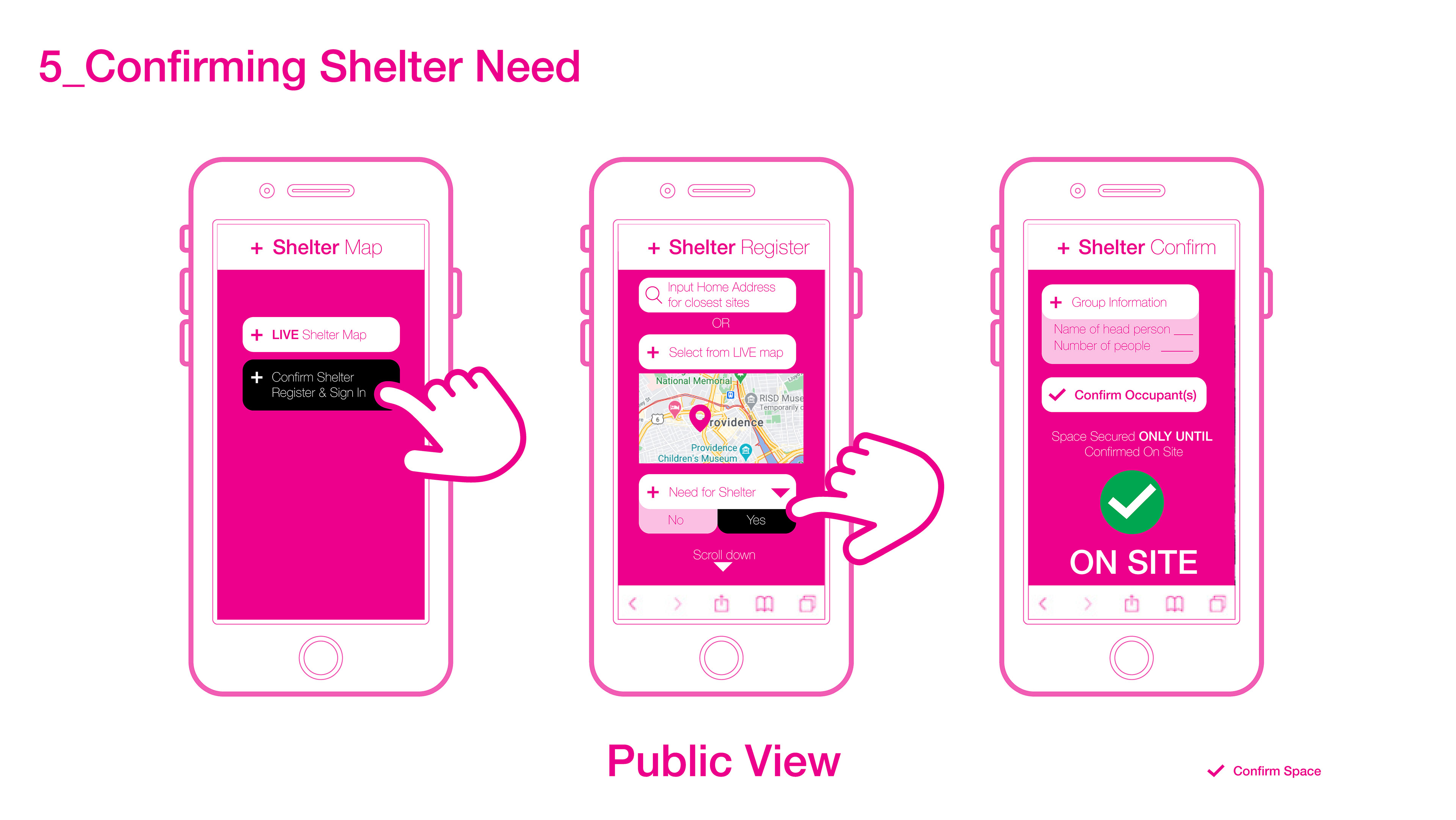
SYSTEM APPLICATION GOALS AND DESIGN FOR SHELTER MANAGEMENT USE
Below describes the expected design tactics for an application that is incorporated to the already existing RiskMap.us by the Urban Risk Lab. Given are the expectations and goals for real use before going into the process of designing the UX part and translating the grasshopper code to one that allows for participatory application of the data.